Path lenght:
See General Info
Molare Dam
3.5 Km
100 mt
Medium
No
October
A giant is hidded
between
vegetation,
a warning for
the future.
THE FORGOTTEN GIANT
Path lenght: 3.5 km.
The forgotten Giant
We share the coordinates:
44.571449, 8.606173 Start from the lake of Ortiglieto
(Copy and paste in Google Maps search label)
General information
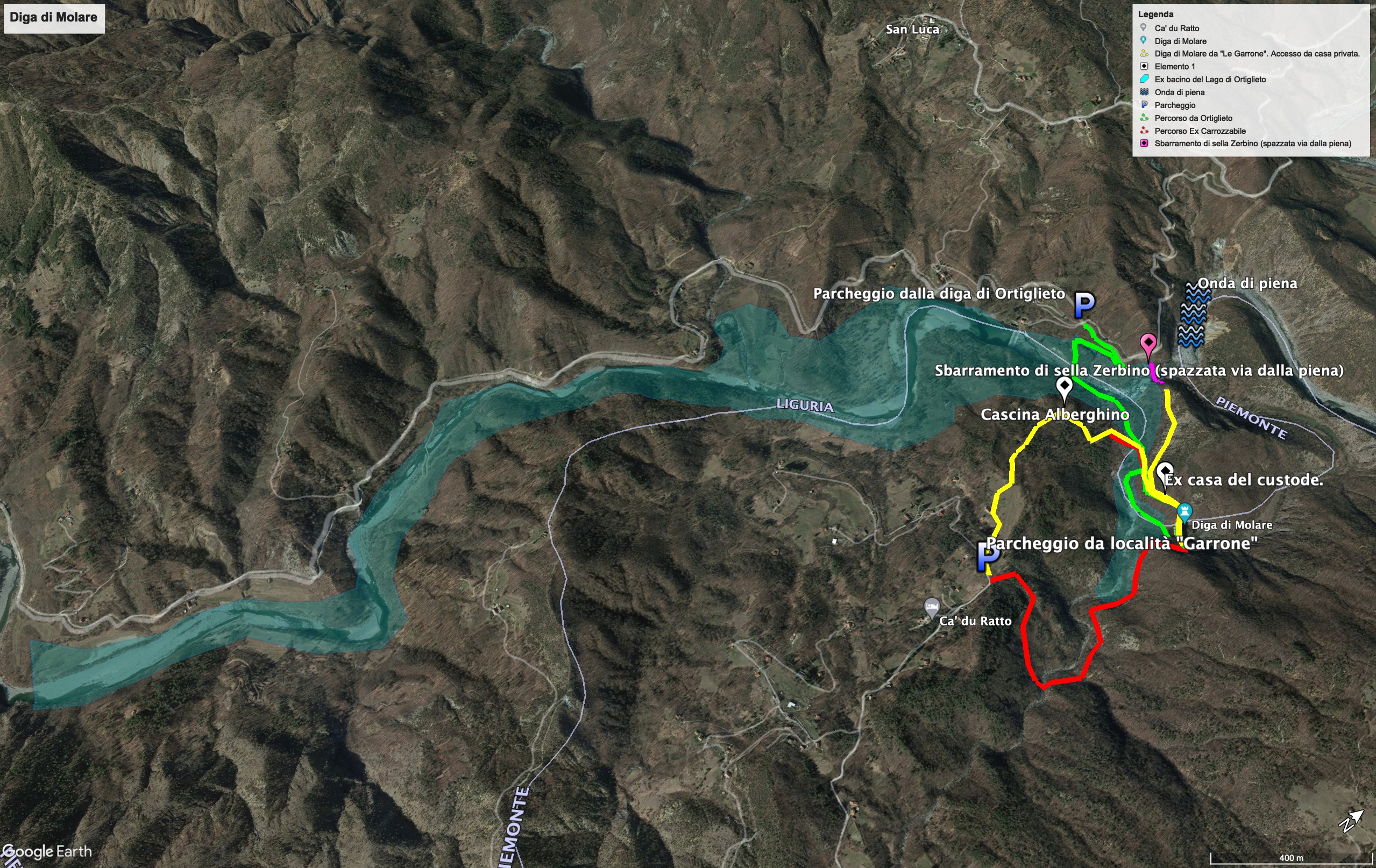
Below we list the possible starting points for visiting the Molare dam:
1) Location Le Garrone, near the old carriage road. The old carriage road leads to the right shoulder of the Molare dam. The path presents no difficulties except at the point where it reaches the dam. To go up the dam you have to climb a small stony ground on the right, before the slide (be careful!)
2) Location Le Garrone, asking for permission to move into private land. Using this path you will arrive at Cascina Alberghino, cross the bottom of the lake and ford the Rio delle Brigne. Once you have taken the path that leads to the dam you will find yourself on the left shoulder.
3) Location Ortiglieto. This is the simplest itinerary. Leave the car in Ortiglieto (park along the road near the lake of the same name) and take the path that runs alongside the settling tanks. Then ford the Orba and go up the path that will lead you to the old guardian's house, on the left shoulder of the Molare dam.
All the routes do not present particular difficulties, but since there are no signs, signs and fields, we recommend, at least for the first time, doing them in the presence of local guides.
For route maps, go to the end of this article.
Introduction
The human being, during his evolutionary path, has learned to exploit the natural elements to obtain energy: he has been able to capture the sunlight and the nuclear reactions between particles, and has harnessed the force of water, wind and heat from the deepest layers of the planet; for its activities it has found deposits of fossil fuels and hydrocarbons, and is constantly looking for new sources of energy.
Early 1900s: the unstoppable rush for white coal in the Orba valley
Precisely the exploitation of water in the form of hydroelectric energy laid the foundations of Italian development between the end of the 19th century and the beginning of the 20th century, decades in which the power of water satisfied 85% of the national electricity needs.
For this reason, water, in an Italy poor in raw materials such as coal and oil, was called “white coal”. (Enel reference).
The borders between Liguria and Piedmont also became a land of conquest in the hydroelectric race: the barriers of the Gorzente stream, near the Capanne di Marcarolo, gave birth to the Gorzente and Lavagnina lakes.
At that time it was also thought to exploit the water of the Orba, a stream that rises along the northern slope of Mount Reixa (link beigua article) which, instead of heading towards the Ligurian Sea, runs almost 70 km before joining the Bormida, one of the tributaries of the Po.
The technicians at the time identified the construction point of the dam near the town of Molare, an area where the Orba continues its journey, forming picturesque meanders set in the narrow rocky gorges.
The initial project for the construction of the dam provided for a barrier only of limited height, but the possibility of electrically exploiting the Orba made the contractors greedy, which modified the project several times and began work at the turn of the 1920s, overcoming both the complaints from the people of the valley and the in-depth analysis and technical improvements imposed by the Gleno commission.
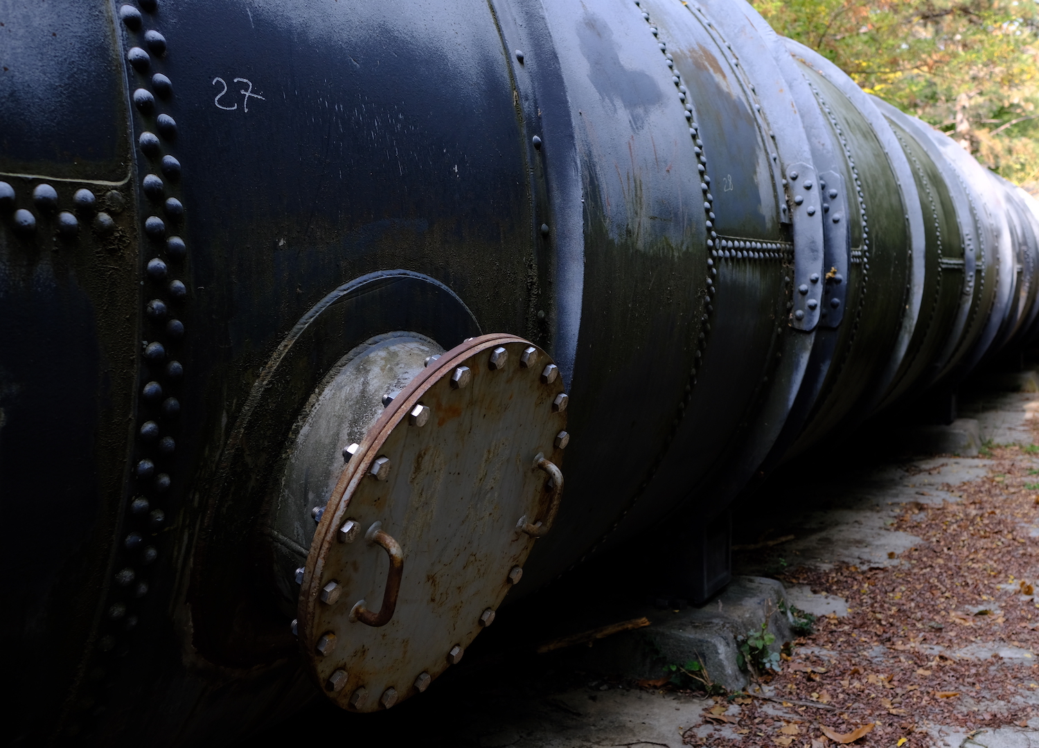
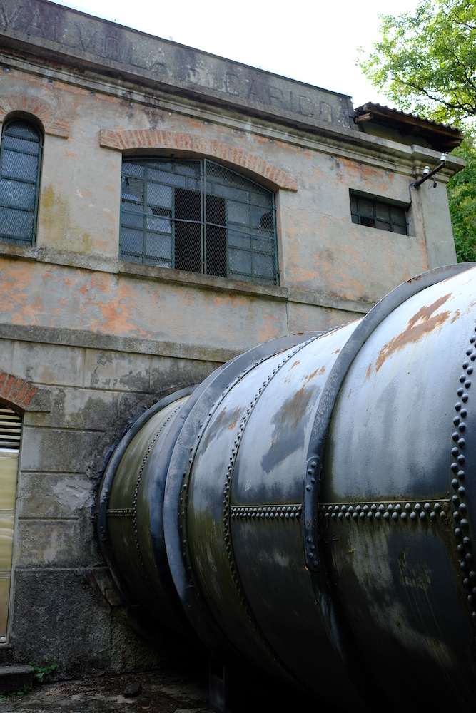
The construction of the dam ended in 1925: the great lake of Ortiglieto was born, whose water was conveyed under pressure in a 3 km long loading tunnel, and carried to the turbines of the downstream power plant located in Madonna delle Rocche, by means of a penstock the final.
According to many, this line was the most important expense item of the whole project, which also included a second barrier 15 meters high. positioned on the Zerbino saddle, the point where the meander of the Orba turned right and headed towards the main dam.
The carriage road was thus continued on the secondary dam and the emergency telephone line passed.
Before the inauguration of the new basin, Sella Zerbino gave some alarm bells with the infiltration of water that crossed the layers of rock, considered solid. However, the operators of the dam, eager to sell energy, did not investigate the problem, on the contrary, they almost hid it, hastily submerging it in concrete.
2021
We met our local guide and the geologist Vittorio Bonaria at Le Garrone, a remote hamlet of Rossiglione, a small town in the Stura valley.
Vittorio dedicated a lot of study to the whole story, and this article was possible to write thanks to his book and his commitment during his explanations.
For those wishing to learn more, we refer to his website www.molare.net, where other topics of the territory are treated in addition to the tragedy.
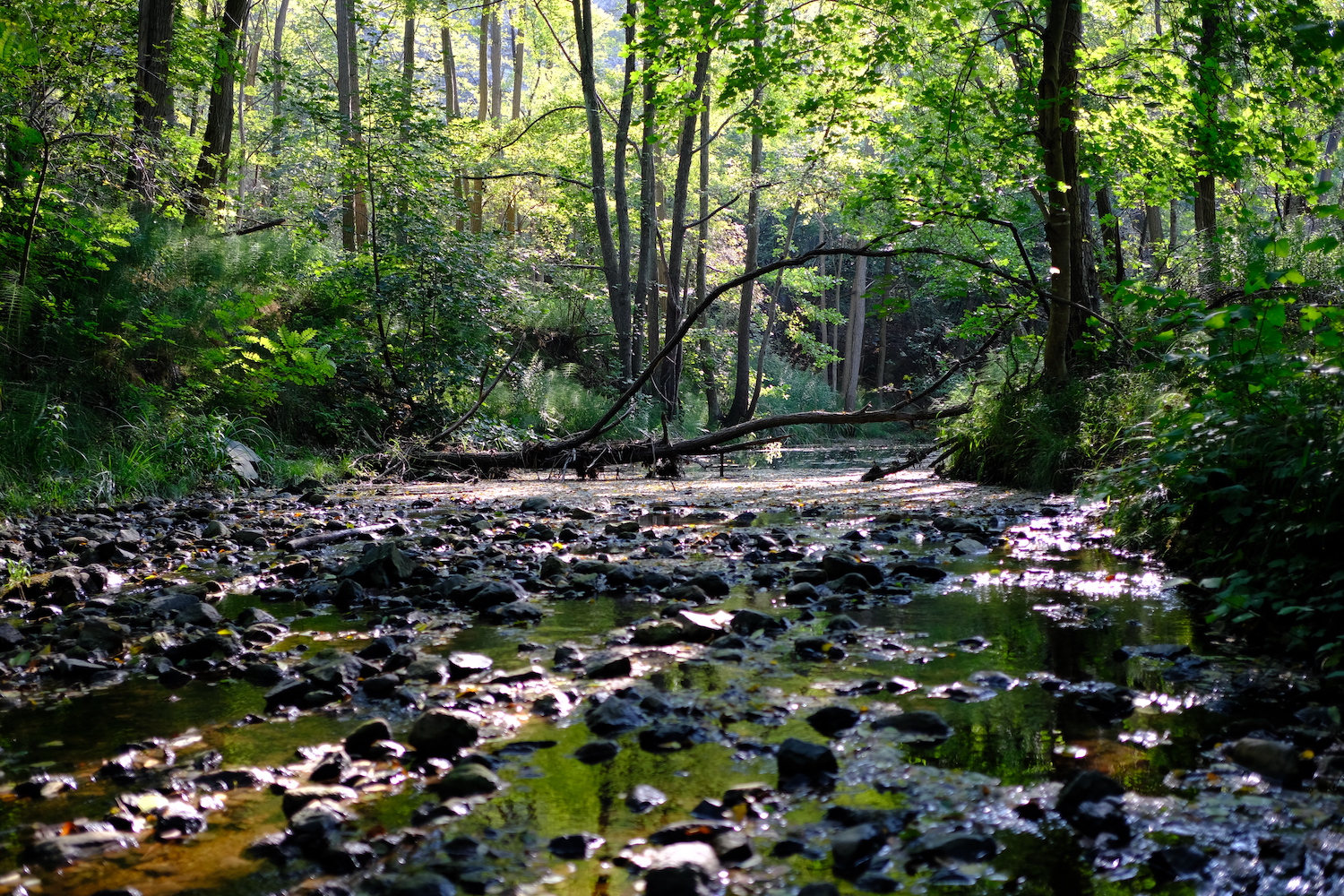
The day was ideal, with a beautiful sun that warmed almost like in summer.
After asking a kind lady for permission to pass through her land, we walked through the dense woods towards the first stop of the day, the ruins of Cascina Alberghino, which was once a stone's throw from the basin of the great lake of Ortiglieto. After passing it, we descended with small bends to Rio delle Brigne, once the bottom of the lake.
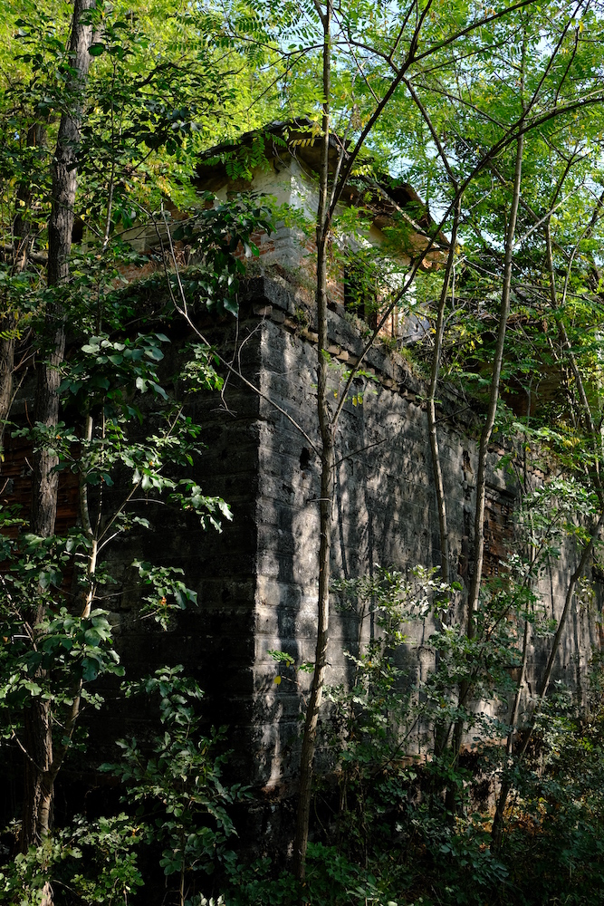
We then forded the small stream without difficulty and entered a more humid area.
At a certain point we took the path to the right and, after about ten minutes, we found ourselves above the old carriage road that would have led us to the guardian's house.
We were in an impervious and almost primordial area, where an impenetrable forest of mixed trees, with many chestnut and hazelnut trees, hid the forgotten giant in its arms.
That August 13, 1935.
The Italian summer almost always brings scarce rainfall: the farmers of the Orba valley knew it well, but they would never have expected a drought as severe as that of 1935.
They hoped for almost the whole summer, waiting for a providential rain that would guarantee the rescue of the crops, now reduced to the limit.
The same O.E.G. (Officine Elettriche Genovesi), the company that managed the dam, was forced to reduce electricity production, and close the latter's drains.
At dawn on August 13, the prayers of the peasants were heard, because in the distance they saw dark clouds laden with rain approaching.
It began to rain.
The rain became insistent, so insistent as to cause a real storm that hit the whole valley with extreme violence. The rain gauges of the time recorded unprecedented accumulations, with hundreds of millimeters that fell in a few hours over the entire drainage basin of the artificial lake of Ortiglieto.
So much water fell that the runoff necessary to decrease the water in the lake, which reached alarming altitudes, was 2,200 / 2,300 cubic meters per second: an event that statistically occurs once every 1000 years!
The guardian of the Molare dam, Abele De Guz, did everything in his power to operate the drains, but it was not enough, because the water was too much and the level continued to rise ... and to rise so much that it reached the altitude of the road, starting to collapse, both from the main dam of Molare and from the dam of Sella Zerbino.
A few moments later, while the water exceeded the level of the dams by more than 2.5 meters, De Guz saved himself with his family by climbing to the roof of the house, and continued to report the serious danger downstream through the direct telephone line. with the power plant.
At 1.15pm the downstream connection was interrupted: the telephone line that ran above the dam of the Zerbino saddle was taken away by the water, and with it all the saddle and the secondary dam.
25 million cubic meters of water, mud and debris completely annihilated the Zerbino saddle, and began a race of devastation and death. Only the heavy turbines remained of the downstream power station, while the rest dispersed among the waves.
The flood wave 20 meters high swept away everything, trees, animals and people along the way, and reached Ovada, where it killed more than 100 people.

2021
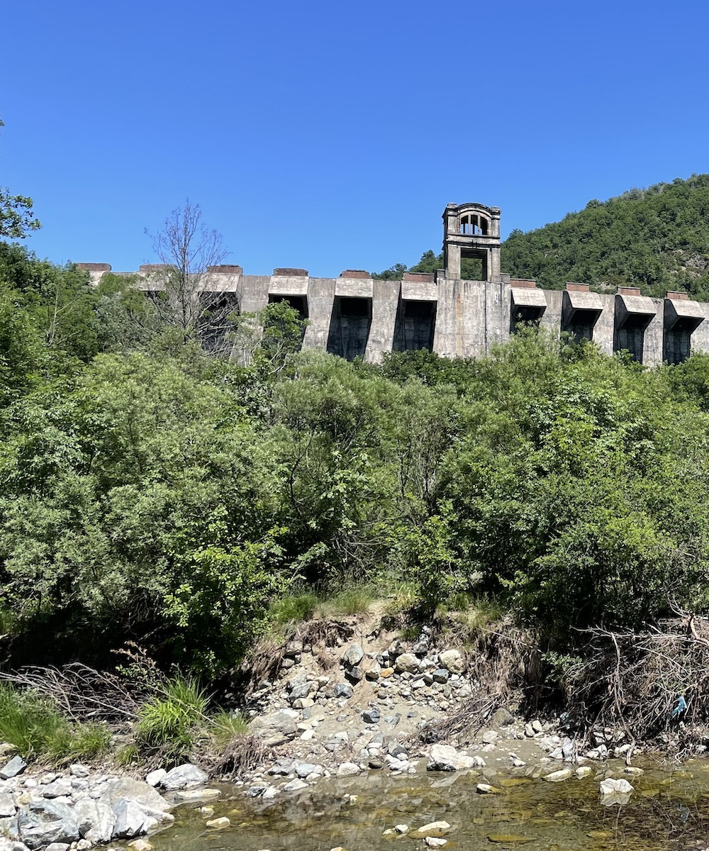
Before our eyes was the imposing Molare dam, which remained standing despite the historical rainfall that hit the Orba valley in the sad August 1935.
The dam was built in the middle of two solid rocky shoulders, unlike the secondary concrete one of Sella Zerbino.
Post-disaster period
In the days following the disaster, a special commission was set up to find out who was responsible for the disaster. After almost 4 years of trial, all the defendants, including the design engineers and managers, were acquitted because the exceptionality of the weather event was blamed. In reality, the disaster had to be quickly forgotten, because it was synonymous with inefficiency in a period where efficiency was celebrated with fascist propaganda.
Sella Zerbino did not yield due to the extraordinary nature of the extreme event, but because man accelerated what would have been the natural destiny of the place by thousands of years: the area presented structural discontinuities in some points, capable of disintegrating under strong pressure.

The geology of the territory was not studied in depth, and only superficial research was carried out. No dam of this size should ever have been built there.
In order not to let the "dreams of glory" die definitively, in 1940 O.E.G. decided to build a small overflow barrier in Ortiglieto (still present today), and reuse the very expensive loading tunnel (no longer under pressure) to power the new small plant built on the rubble of the larger one.

2021
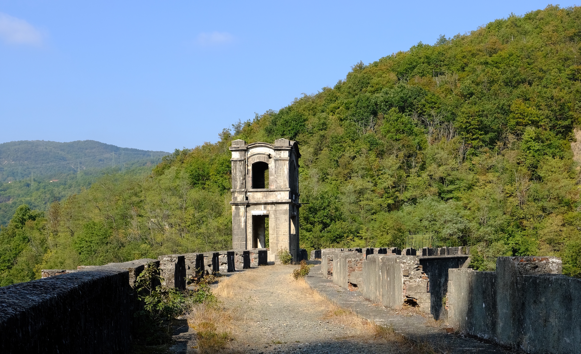
The view was surreal, with this abandoned building contrasting with the lush nature around.
We then walked along the dam walkway and went back, continuing towards the former Zerbino saddle, which we reached along the old carriage road.
At the end of the road, which has become almost a trace due to the incessant advance of time, we saw the gash caused by the fury of the water of that day, where the Orba now passes.
Before going back to the starting point it is possible to arrive at the foot of the dam: it is necessary to return to the Rio delle Brigne and follow its course with a little imagination. You will thus be able to see the dam from another point of view among the dense vegetation that covered the site of the disaster.

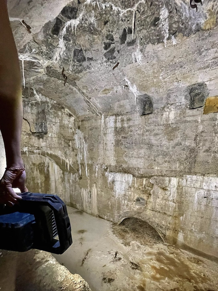
The interior of the dam can be visited, but we do not recommend doing it alone.
We have relied on the Centro Studi Sotterranei, which has been operating for decades organizing visits of this type and has its headquarters in the Genoese area.
In the belly of the giant, walking carefully on what remains of the steps, there were still ceramic tiles that indicated the height, and once you reached the base of the dam you could see both the calcium carbonate concretions typical of the hypogeum environment, and the floor of “muddy quicksand”, where the external light coming from the bottom drain filtered through the darkness.
We recommend taking all these paths to see with your own eyes that forgotten giant, which seems suspended in time: it is still standing there, as a warning for future generations not to repeat the same design mistakes and underestimate the risks by thinking only of profit.
Trekking Map
That's all! If you like this text or have any question, leave a comment below.


Comments powered by CComment